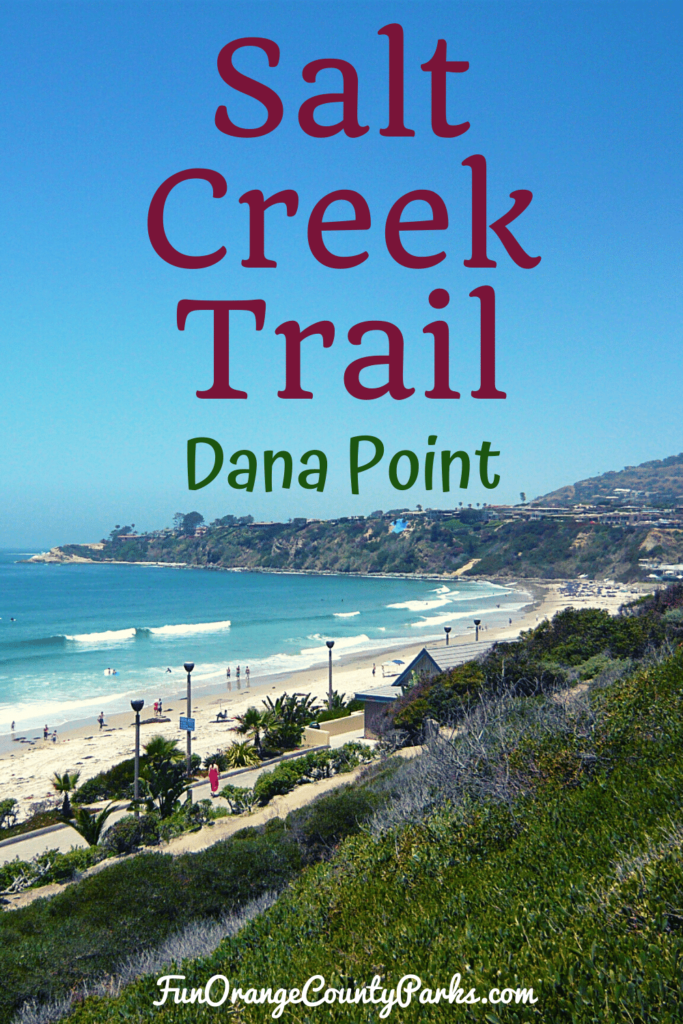
Salt Creek Trail which runs from inland in Laguna Niguel to the beach in Dana Point is one of my favorite walks with the kids.
I've done it with them in a stroller and this time they were old enough to walk on their own.
The ocean breeze, and sometimes fog, make for a cool excursion when temperatures heat up inland.
It's also great because you can choose to do sections instead of the whole thing.
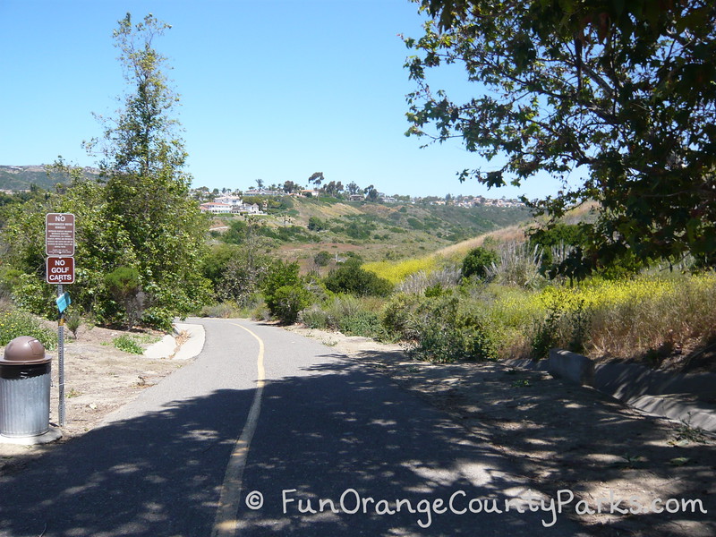
How to Get to Salt Creek Trailhead: We parked on Camino Del Avion between Niguel Road and Crown Valley Parkway. You'll be on the correct side of the street if you drive from Camino Del Avion toward Crown Valley. Otherwise, you'll have to turn around to park in the right direction. Park along the street and walk toward Crown Valley. As the sidewalk starts to slope downward, you'll see a bike path off to your right. Take this path, then bear to your left crossing under the street and heading toward the beach. MAP TO SALT CREEK TRAILHEAD (See aerial view of trail)

Salt Creek Trail Hike from Camino del Avion to the Beach
The Salt Creek Trail hike I'm about to describe is a loop from parking along Camino del Avion, taking the trail down to the beach, walking along Salt Creek Beach, then up the big hill at the main entrance to Salt Creek Beach and back up Niguel Road to your car. This loop takes about 2 hours walking at a very leisurely pace.
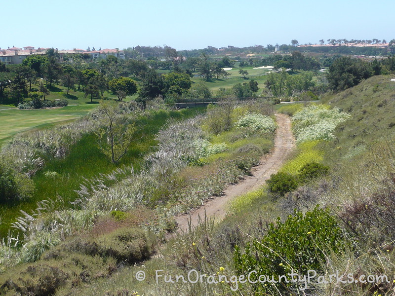
You'll start off walking down a gorgeous canyon down toward the beach. Keep your eyes out for wild artichoke plants, lizards, rabbits, swallows and many other birds.
We saw a red tail hawk and mockingbirds, too.
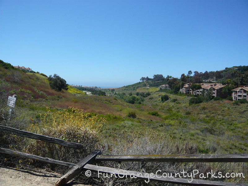
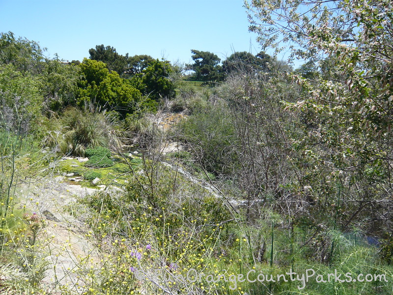
There's a golf course on your left and the creek which makes for a riparian habitat.
See if the kids (and you) can tell where the creek is by spotting the lush green vegetation amongst the dry brush.
Toward the bottom of the hill is the Gelson's Grocery at Monarch Beach Plaza. You can't really see it from the trail, but you can see a dirt path on your right with sand bags lined across it. This is another option for catching up with the trail.
We often start from here to avoid the very big uphill on the way back and it makes it a more manageable out and back walk if we only want to spend under an hour.
From here, you'll come to a bridge on your left leading over to the Waldorf Astoria Monarch Beach Resort & Club property. There is a botanic garden on the hotel grounds and access to the landscaped Sea Terrace Park.
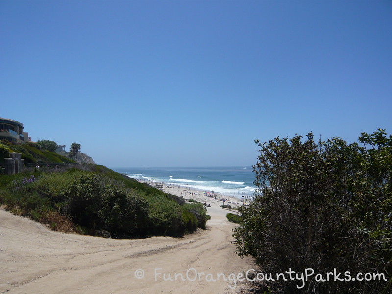
I'd recommend continuing on the main public trail instead, because you get to go through a TUNNEL! When you come out of the dark tunnel, you're rewarded by your first close-up glimpse of the ocean.
Take the trail to your left (watch for golf carts) and walk the sidewalk above the beach. Beautiful!

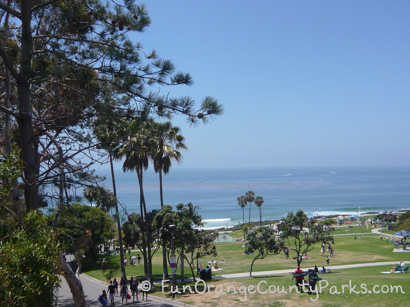
Continue all the way to the main Salt Creek Beach above the snack bar and follow the road up to the street.
Then walk along Niguel Road all the way back up to Niguel Road and back to the car. An alternative is to turn left into Sea Terrace Park after crossing Pacific Coast Highway to catch up with the trail and take that back (although I think it's much steeper).
Highlights:
Although the canyon can be hotter than the beach, it's nice and cool compared to inland trails.
It's a great family outing for a lazy weekend afternoon. You can even make a day of it by bringing sand toys and a towel so the kids can take a dip after their long walk.
Generally not too crowded or busy.
6 Ways to Customize Your Hike
- You can go the way I illustrated above.
- Or you can do the same thing in reverse by starting on Niguel Road and walking down to Salt Creek Beach and up around on the trail.
- You could use your OC Parks pass and park at Salt Creek Beach and start your loop either way from there.
- I like starting at the Monarch Bay Plaza and just walking out to the beach and back up the trail to make it a very simple walk with big view payoffs and it doesn't take much time.
- You can include stops at Moulin Dana Point for breakfast/lunch, the Dana Point Library at the corner of Coast Highway and Niguel Road, or Gelson's Grocery for their deli or bakery items to get a picnic lunch.
- You can GREATLY extend the distances for this trail by adding on the Laguna Niguel sections of Salt Creek Trail (map) which go all the way up to Laguna Niguel Regional Park and through Chapparosa Park on their way to the beach.
Be Aware:
- It's a long walk. If you or your kids are not used to long walks, then better to attempt something like the North Beach Trail in San Clemente where turning around doesn't mean a big uphill slog back to the car.
- The way back is uphill.
- You must bring water (and snacks if your kids need those).
- At the bottom of the trail near the tunnel, you'll be competing for the road with golf carts. I'd recommend keeping your eyes out and staying on the sidewalk.
- The walk took us two hours and we were moving, albeit slowly, the whole time.
- I've run this by myself during the week, but it's a bit isolated in spots. I'd recommend bringing a friend.
Checklist:
- Parking on the street near the trailhead
- Paved path - great for strollers
- NO restrooms or water until you get to Salt Creek Beach
- Leashed dogs allowed on the trail, but no dogs allowed on the beach
- Not a good walk during wet weather -- the hillside has a tendency to get muddy and slide onto the trail
- Bring plenty of water to drink and plenty of energy for the uphill on the way back to the car!
- Hats and sunscreen highly recommended.
- Grown-ups don't forget your sunglasses and camera.
- City of Dana Point map to the Salt Creek Bike Path which is where this walk happens
- Map of Laguna Niguel section leading to Salt Creek Trail (not spotlighted in this post, but you can add a Laguna Niguel section to your Dana Point section described in this post for a MUCH longer hike)
Originally published June 2010.